No data needed.
Never lose your bearings. Navigate trails with precise trail paths, fully functional with no cellular data. Hike stats are saved for later, so you can review memories or share with friends.
Saved routesLive pathTrail stats

Windward Atlas
Windward Atlas uses local expertise to offer a seamless hiking experience in Dominica.
Local trail data
Offline maps
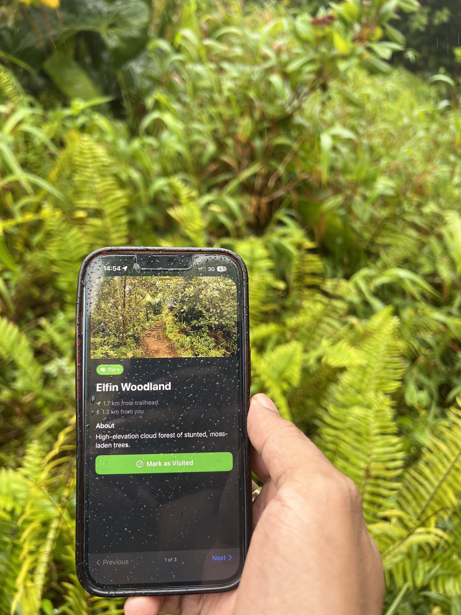
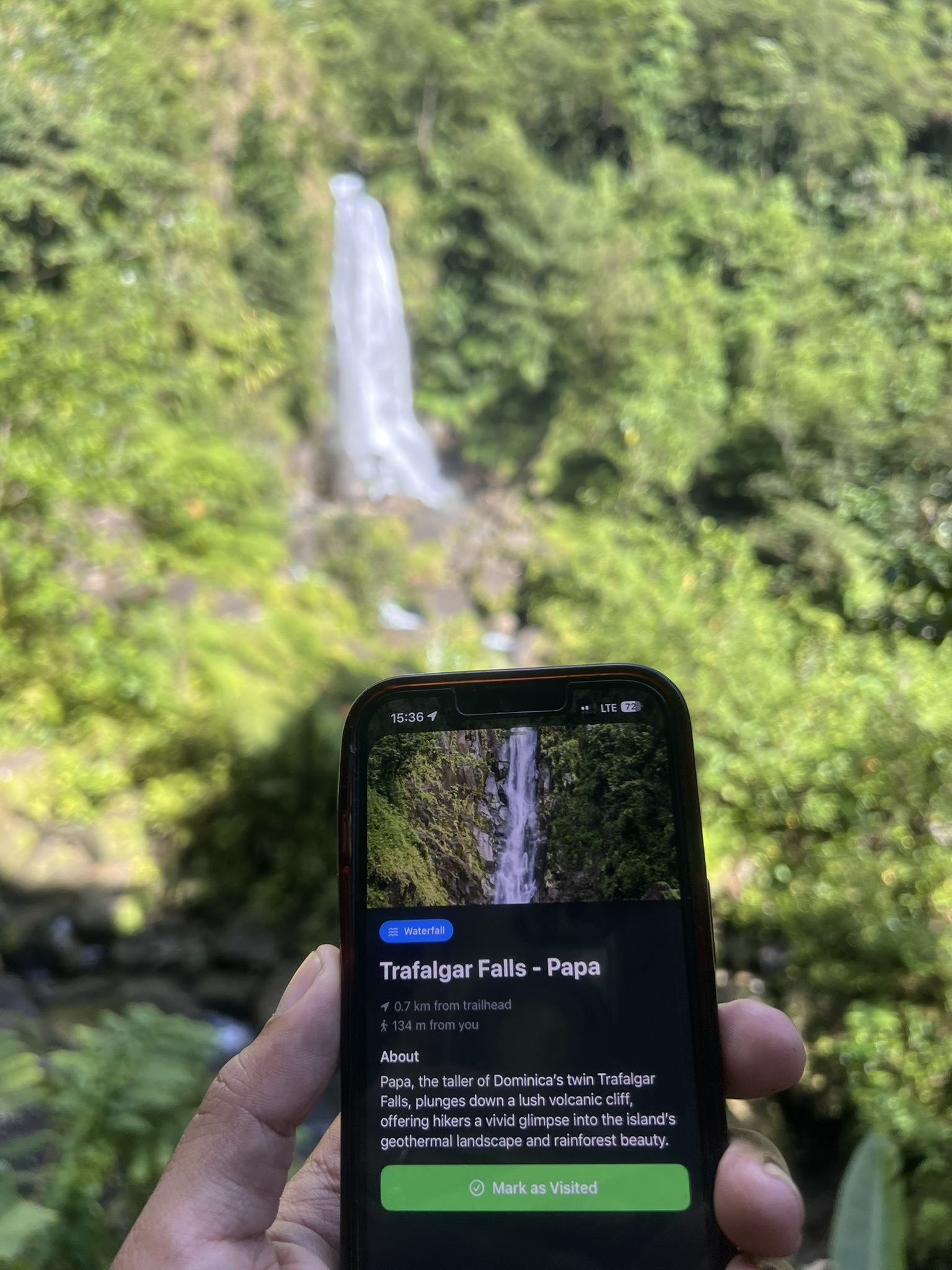
Sight and warning waypoints
Windward Atlas delivers local trail knowledge so you can explore our densest forests with confidence.
Leave no stone unturned, and no sight unseen.
Never lose your bearings. Navigate trails with precise trail paths, fully functional with no cellular data. Hike stats are saved for later, so you can review memories or share with friends.
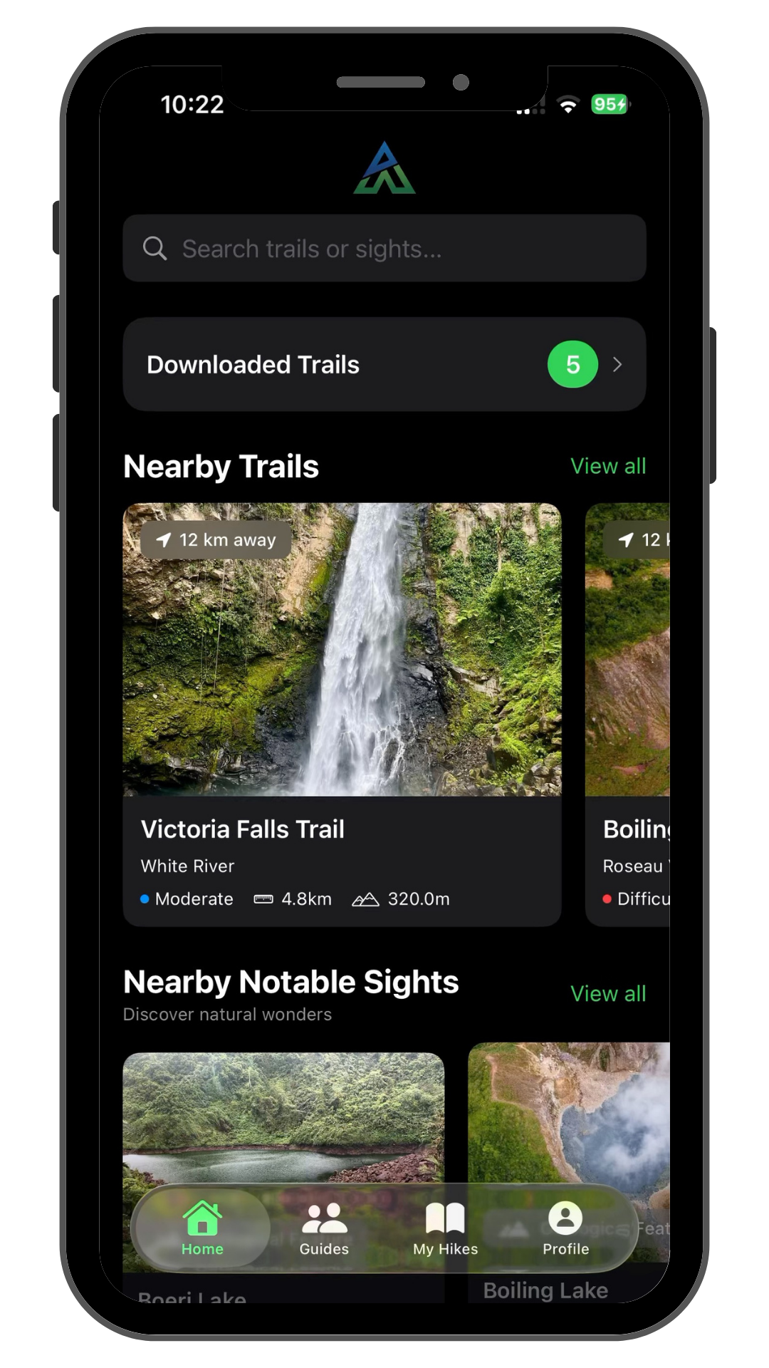
Find the ideal trail with rich search and discovery. View popular trails, search by difficulty, or even what sights you want to see.
View important waypoints embedded directly into your trail path. See jaw-dropping sights on trail, potential hazards, and advice from guides and other hikers.
Local guides are the core of this service. Hire trail experts directly in app to take your hikes to another level, no extra charge to you.
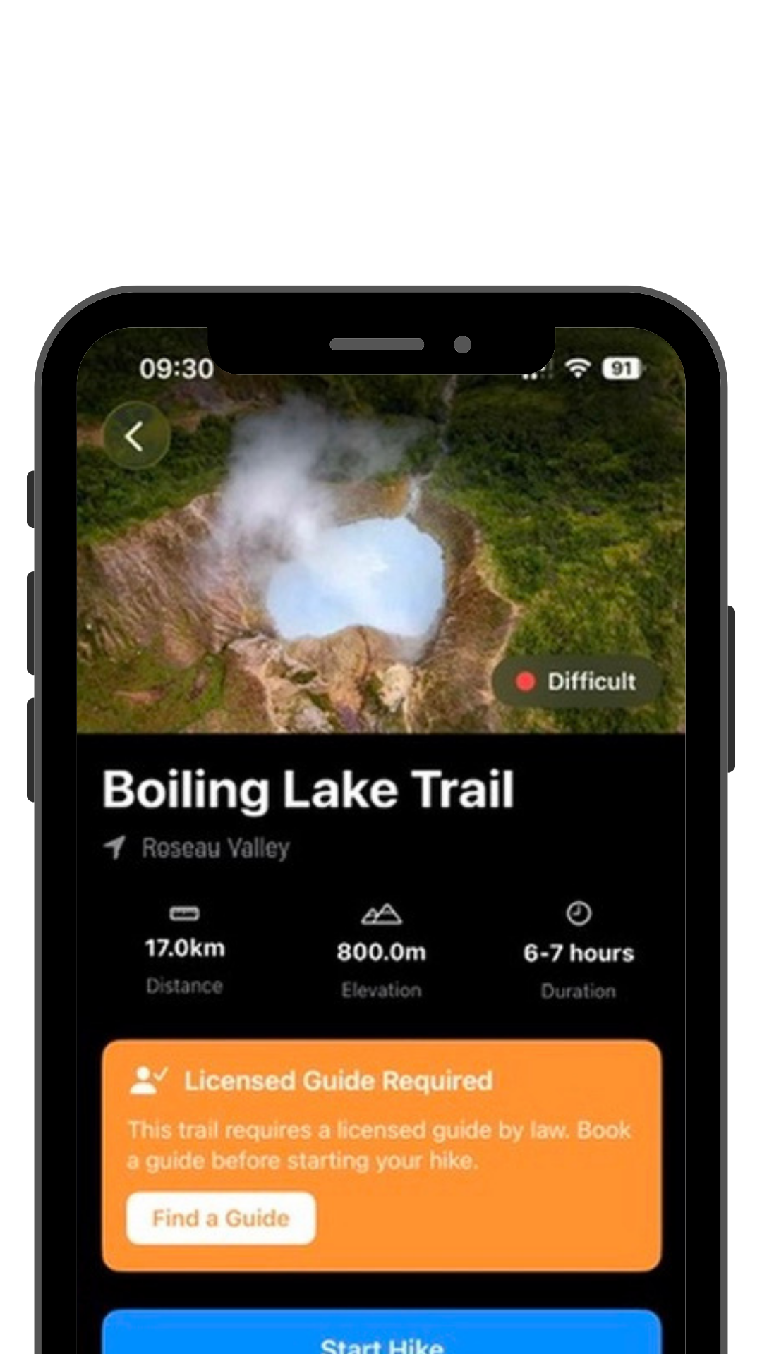
We partner with licensed guides and hikers who know these trails best to keep information accurate and updated. So that we can offer a better hiking experience across Dominica.
Stay up to date with Windward Atlas progress and get access to exclusive content before launch.
We are targeting the end of 2026 for public release.